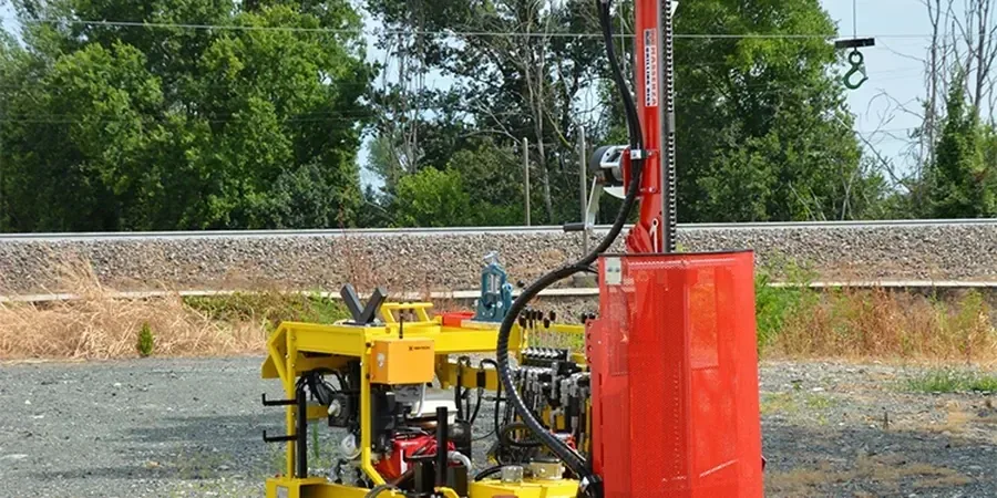
One of the most frequent mistakes we see in Cairns is treating the coastal plain as uniform ground. A developer runs a few boreholes near the Esplanade, assumes the profile extends across the site, and then hits buried mangrove deposits or loose silty sand at depth. That assumption can cost months and tens of thousands in foundation redesign. SPT drilling based on AS 1726 helps you avoid exactly that scenario. The standard penetration test gives you blow counts (N-values) every 1.5 metres, which translate directly into relative density and bearing capacity estimates. In a city where the water table sits barely two metres below street level in many suburbs, the split-spoon sampler also recovers a disturbed sample that tells you whether you are dealing with clean quartz sand, clayey silt, or organic-rich estuarine mud. For deeper profiling where continuous data is needed, we often combine the SPT with a CPT program to map transitions between loose and dense layers without gaps.
In Cairns, the difference between a stiff residual clay and soft estuarine sediment can occur within a single block—SPT blow counts tell that story before excavation even begins.
Service characteristics in Cairns
Typical technical challenges in Cairns
The contrast between two Cairns suburbs illustrates why local SPT data matters. In Edge Hill, the residual clay derived from the Barron River metamorphics is stiff, with N-values routinely above 30 below three metres. Foundations there are straightforward. Drive ten minutes east to Portsmith, and you are on Holocene estuarine sediments—soft, normally consolidated clays where N-values of 2 to 5 persist to 15 metres depth. The same building design will behave completely differently in these two settings. Without site-specific SPT drilling, you are either overdesigning and wasting money, or underdesigning and courting differential settlement. Liquefaction potential adds another layer of complexity. Cairns sits in a moderate seismicity zone, and the saturated loose sands found in the lower Barron delta and along the former mangrove fringe can lose strength during a design earthquake. Youd and Idriss (2001) procedures, applied to corrected N1(60) values from SPT data, provide the standard framework for liquefaction screening under AS 1170.4. We have seen sites where the trigger depth was only 4 metres—shallow enough to affect strip footings, not just deep piles.
Our services
Our SPT work in Cairns supports a range of project types, from single-lot residential to infrastructure corridors. We tailor the borehole layout to the geology, not just a grid, and we report data in formats ready for your structural or geotechnical engineer.
Residential and low-rise SPT drilling
Two to four boreholes on standard house lots, with N-value profiles and disturbed samples for laboratory classification. We focus on the upper 8–12 metres where footings and slabs interact with reactive or compressible soils common in Cairns' western suburbs.
Commercial and mid-rise investigation
Deeper boreholes (15–25 m) for multi-storey buildings, typically on the coastal plain from the CBD to Aeroglen. We provide N60 profiles, liquefaction screening, and preliminary pile capacity estimates for engineers working to AS 2159.
Infrastructure and corridor SPT programs
Linear borehole arrays for roads, embankments, and retaining walls along the Captain Cook Highway or Barron River crossings. Includes groundwater monitoring and soft-ground identification where the alignment crosses former wetlands.
Q&A
What does a typical SPT investigation cost for a Cairns house block?
For a standard residential site in Cairns with two to three boreholes to 6–8 metres depth, you are looking at a range of AU$930 to AU$1,260 including the driller's log and laboratory classification of split-spoon samples. Access constraints in steep Mount Whitfield foothill sites can push that toward the upper end.
How do you handle the high water table in Cairns during SPT drilling?
We advance the borehole using hollow-stem augers or mud rotary methods to keep the hole open below the water table. The split-spoon is driven through the auger stem, so the test proceeds normally. We also record the water level at the start and end of each shift—in suburbs like Holloways Beach, it is not unusual to strike groundwater at 1.2 metres.
How many SPT boreholes does a Cairns project need?
AS 1726 recommends a minimum of three boreholes for a single-lot residential investigation, and more for larger footprints. In Cairns, we often add extra holes if the site straddles two geological units—for example, the contact between alluvium and residual soils along the base of the Whitfield Range—because N-values can change dramatically over short distances.