A common mistake we see in the Cairns region is treating a weathered slope profile as if it were a uniform, competent mass. When the first heavy wet season arrives, the contrast between the stiff upper layer and the deeper, saturated residual soil triggers a failure that could have been predicted. Cairns is built on ancient metamorphic and granitic rocks that have decayed in the tropical climate for millennia, producing thick, variable horizons where strength can drop sharply with depth and moisture. A proper slope stability analysis digs into those contrasts before the excavation begins, avoiding costly emergency remediation. We pair this assessment with test pits to map the true weathering front and triaxial testing to define the effective stress parameters that govern long-term stability in these saturated conditions.
In Cairns, a slope's stability is governed less by the intact rock strength and more by the pore pressure response of its weathered mantle during a monsoon.
Service characteristics in Cairns
Typical technical challenges in Cairns
AS 4678-2002 requires that both short-term and long-term pore pressure scenarios be evaluated, but in Cairns the critical condition is almost always the undrained loading case that develops during a multi-day monsoon event. The Barron River delta and the foothills around Whitfield and Edge Hill sit on deeply weathered metasediments where a high-intensity rainfall can raise the phreatic surface by several meters in less than 24 hours. A slope that shows a comfortable factor of safety under drained, steady-state conditions can approach unity when this transient pressure is not captured in the model. The consequence of underestimating this is not just a report discrepancy; it is a slope failure that can close the Kuranda Range Road, damage residential lots, and require emergency earthworks that far exceed the cost of a thorough analysis. We also cross-check our results with liquefaction assessments where loose, saturated fills are present at the toe, since that mechanism compounds the instability.
Our services
Our approach in Far North Queensland starts by recognizing that no two slopes behave the same way once the monsoon arrives. We tailor the investigation and modeling to the specific failure mechanisms observed in the Cairns region.
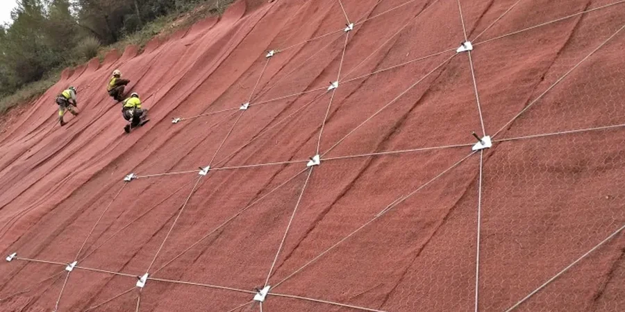
Limit Equilibrium & Numerical Modeling
We apply Spencer and Morgenstern-Price methods for rotational and translational failures, coupled with finite element analysis when the interaction between a retaining structure and the slope mass is critical. Our models incorporate the suction profile of the unsaturated zone, which often provides the additional apparent cohesion that keeps a Cairns slope standing during the dry season.
Post-Cyclone Slope Audits
After a tropical cyclone crosses the coast near Cairns, we execute rapid stability reassessments. We measure pore pressure response from installed piezometers, compare it with pre-event conditions, and update the factor of safety to reflect the new groundwater regime before the next construction phase proceeds.
Q&A
Why do slopes in Cairns fail so often during the wet season?
Cairns receives over 2000 mm of rain annually, with most of it concentrated in the summer monsoon. This rapid infiltration saturates the upper residual soil, destroying the matric suction that acts as a temporary cohesive bond. The pore-water pressure rises sharply, reducing effective stress along the slip surface until the driving forces exceed the shear resistance.
What design standard governs slope stability in Queensland?
AS 4678-2002 «Earth-retaining structures» is the primary standard, supplemented by the Queensland Department of Resources guidelines for landslide risk management. For seismic and cyclonic loading, we integrate the site hazard factors from AS/NZS 1170.2 and 1170.4 to determine the appropriate horizontal acceleration for the pseudo-static analysis.
What is the typical cost range for a slope stability analysis in Cairns?
A complete analysis, including field investigation, laboratory triaxial testing on undisturbed samples, and the limit equilibrium or finite element modeling, generally ranges from AU$1.770 to AU$7.210. The final figure depends on the slope height, the complexity of the stratigraphy, and whether time-dependent transient flow modeling is required.
How do you account for the risk of shallow landslides in the Redlynch Valley area?
The Redlynch corridor features steep, colluvium-mantled slopes that are susceptible to shallow, rapid failures. We focus on the interface between the colluvial blanket and the underlying weathered bedrock, using infinite slope analysis with pore pressure ratios derived from observed groundwater response. This often leads to a drainage solution integrated with the stability model, rather than a heavy structural restraint.