A mid-rise apartment project up in Edge Hill hit an unexpected decomposed granite lens at 8 metres depth — the kind of thing a standard borehole grid can easily miss between drill points. We were called in after the contractor lost two auger flights and the structural engineer needed to know whether the rockhead was a pinnacle or a continuous ridge. Running a combined refraction and reflection seismic tomography line across the site gave us a continuous P-wave velocity profile spanning 60 metres laterally, resolving the granite interface to within half a metre. In Cairns, where residual soil profiles over weathered metamorphic and granitic basement vary wildly across short distances, this method fills the gap between sparse borehole data and the real subsurface geometry. It is not a replacement for drilling, but it is the most practical way to connect the dots when the ground refuses to be predictable. We often pair the tomographic survey with an SPT drilling programme to calibrate velocity boundaries against actual N-values and material descriptions, which gives the geotechnical model the calibration it needs for foundation design under AS 4678.
A tomographic velocity model turns a handful of borehole logs into a continuous subsurface cross-section — and in Cairns' erratic weathered profiles, that continuity is what keeps foundation surprises off the variation claim.
Service characteristics in Cairns
Typical technical challenges in Cairns
Cairns sits in a cyclone corridor with an annual rainfall pushing 2,000 millimetres, and the wet season saturates the upper 4 to 6 metres of soil so thoroughly that seismic velocities drop by 15 to 20 percent compared to dry-season conditions. If you run a refraction survey in February and interpret the low-velocity layer as permanent weathered rock rather than temporarily saturated residual soil, the excavation depth for footings will be overestimated and the contractor will be into rock-breaking plant for no reason. Our field protocols include soil moisture sensors and a rain-gauge log for the 48 hours before shooting, so the processing geophysicist can apply a velocity correction factor calibrated to local Cairns soil types. Lightning is another hazard: a tropical storm can roll off the Coral Sea in twenty minutes, and a 24-channel seismic cable laid across open ground becomes a lightning target. We do not shoot if the Bureau of Meteorology radar shows active cells within 15 kilometres. On reflection surveys, the high ambient noise from wind through eucalypt canopy and from cane-train operations in the Mulgrave Valley forces us to stack shots 6 to 10 times to pull coherent reflectors out of the noise — it takes longer, but skipping the vertical stack produces a section that is uninterpretable below 20 milliseconds two-way travel time.
Our services
Seismic tomography in Cairns is not a one-size-fits-all technique — the acquisition geometry, source type, and processing workflow depend entirely on what the project needs to resolve. Below are the three configurations we deploy most often across the region.
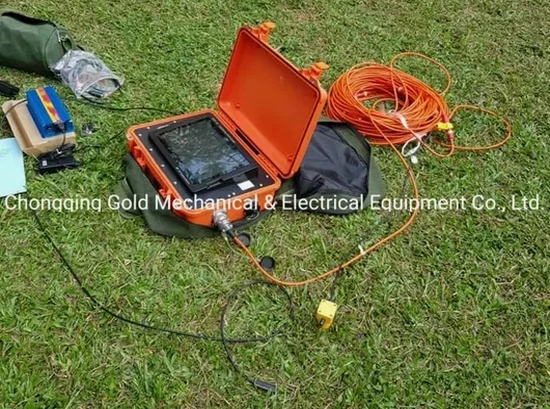
Refraction Tomography for Foundation Design
A 2D P-wave velocity cross-section along building footprints or bridge pier alignments, targeting the top 25 metres. We use 24- or 48-channel spreads with a sledgehammer source, and the tomographic inversion resolves lateral velocity gradients so the engineer can map the rippability boundary and competent rockhead. Calibrated against borehole logs, the velocity model becomes the basis for footing type selection and excavation planning.
Combined Refraction–Reflection for Tunnel Pre-Investigation
When the target is a tunnel crown at 30–60 metres depth, reflection mode with a higher-energy source captures impedance contrasts at the soil–rock interface and within fractured rock masses. We process the reflection data through CMP sorting, NMO correction, and post-stack time migration, then overlay refraction-derived near-surface velocities to correct for statics. This combination is especially useful along the Kuranda range corridor where basalt flows overlie weathered metasediments.
MASW-Informed Tomography for Seismic Site Class
Surface-wave dispersion curves extracted from the same shot records are inverted to produce a 1D shear-wave velocity profile beneath the centre of the spread. The Vs30 value is then used to assign an AS/NZS 1170.4 site class. Because the P-wave tomography and the MASW share the same geophone array, the two datasets are inherently co-located — no spatial mismatch to reconcile in the interpretive report.
Q&A
What seismic source do you use for tomography in Cairns, and how deep can it see?
For refraction targets shallower than about 30 metres, we use an 8-kilogram sledgehammer striking an aluminium plate, which generates a clean high-frequency pulse with enough energy to trigger first arrivals on a 115-metre spread. When the investigation needs to reach 40 to 80 metres — for a tunnel feasibility study or a deep-seated landslide — we deploy an accelerated weight drop trailer that delivers 250 to 500 joules per impact. The actual penetration depth depends on the local geology: in the alluvial clays of the Barron delta, the energy attenuates quickly and 30 metres is the practical limit, while in the hard metamorphics of the Hodgkinson Formation we have picked refracted arrivals from the basement at 55 metres.
How do you calibrate a seismic velocity model against real soil and rock properties in Cairns?
A velocity model alone tells you how fast a seismic wave travels — not whether the material is a stiff clay, a weathered phyllite, or a fresh granite. We calibrate the tomographic cross-section by drilling one or two boreholes directly on the seismic line and logging the core for lithology, RQD, and fracture spacing. The depth to each velocity contour is then matched against the borehole stratigraphy, and the resulting velocity-to-material table is applied across the entire 2D section. For sites where the client has already completed an SPT drilling campaign, we use the N-value profile at each drill location as an additional calibration point, which improves the confidence in rippability and excavatability assessments substantially.
What does a seismic tomography survey cost for a typical Cairns building site?
For a single 115-metre refraction line with 24 geophones and tomographic inversion, the cost ranges from AU$4,430 to AU$9,190 depending on site access, vegetation clearance requirements, and whether we need to bring the accelerated weight drop. A combined refraction–reflection survey with MASW extraction for seismic site class sits at the upper end of that range. Every quote includes the field crew, all acquisition equipment, processing software licensing, and a stamped interpretive report with 2D velocity cross-sections in PDF and DXF format.